Handheld SLAM scanners with Livox Mid-360 — what they actually change in surveying and construction
A handheld scanner built around a Mid-360 cut the survey of a city block from 28 person-days to 2. Here is where that difference comes from — and where the method stops working.

3D scanning turns a real object into a point cloud with known coordinates. For years that was the domain of terrestrial scanners: tripod, station, reference targets, move, repeat — dozens of times over. Handheld SLAM scanners changed the logistics of that work. The operator simply walks through the site while the device builds a map and localises itself within it on the fly.
The sensor that made those devices both cheaper and lighter is, in many designs, the Livox Mid-360.
Why the Mid-360 ended up in handheld scanners
A typical mechanical multi-beam LiDAR weighs close to a kilogram. Add a camera, IMU, power and an enclosure and the complete handheld instrument runs to several kilograms and gets bulky — for a tool the operator holds in one hand through an entire survey day.
The Mid-360 weighs 265 g at 6.5 × 6.5 × 6 cm, and gives up little for it:
- a 360° × 59° field of view — a full hemisphere around the operator
- 200,000 points per second
- range up to 70 m at 80% reflectivity and 40 m at 10%
- non-repetitive scanning — coverage grows with integration time, so pausing longer in one spot yields a denser cloud without changing hardware
Then there is cost. Mechanical multi-beam units run into the tens of thousands; the Mid-360 is a fraction of that. That gap is precisely why the handheld scanner stopped being a tool only large survey firms could justify.

A 20° tilt — the detail that changes how you work
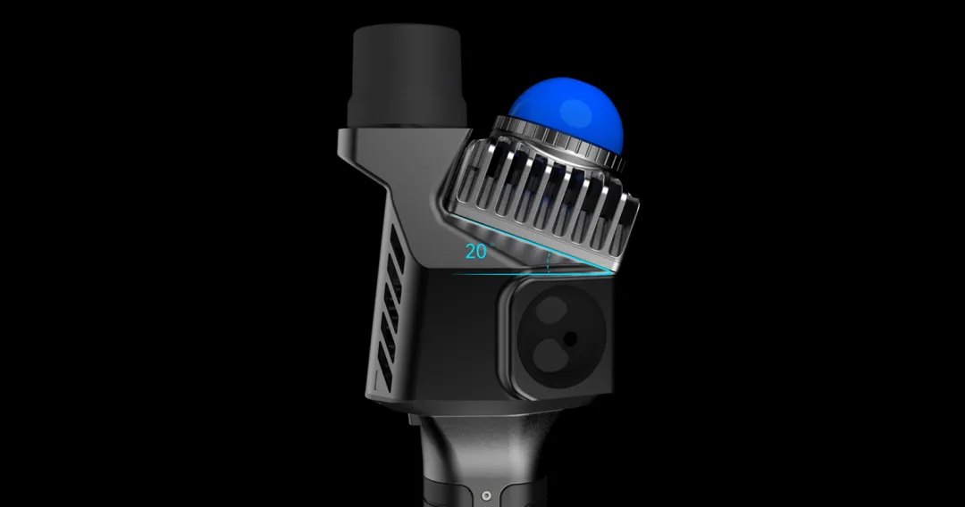
In a typical design the sensor sits neither horizontally nor vertically, but tilted about 20° towards the ground. It looks like a mounting detail; it changes how the work is done.
At that angle a single pass covers the floor, the space ahead of the operator and the ceiling at the same time. Nobody has to rotate their wrist or retrace their steps to "close off" the top and bottom of a room. In practice: fewer passes, fewer gaps in the cloud, and above all fewer return visits — because missing data usually surfaces during processing, long after the crew has left the site.
Three deployments, three different problems
Urban renewal: a city block in one day
A city launches an urban renewal programme for an old district. The problem is always the same: the archived drawings no longer match reality. Decades have added extensions and conversions, street geometry and utilities have shifted. Design work needs a model of what is actually there, not what was there forty years ago.
The classic method is a tape measure and manual dimensioning — slow, error-prone, and easy to leave gaps in; and every gap means another site visit.
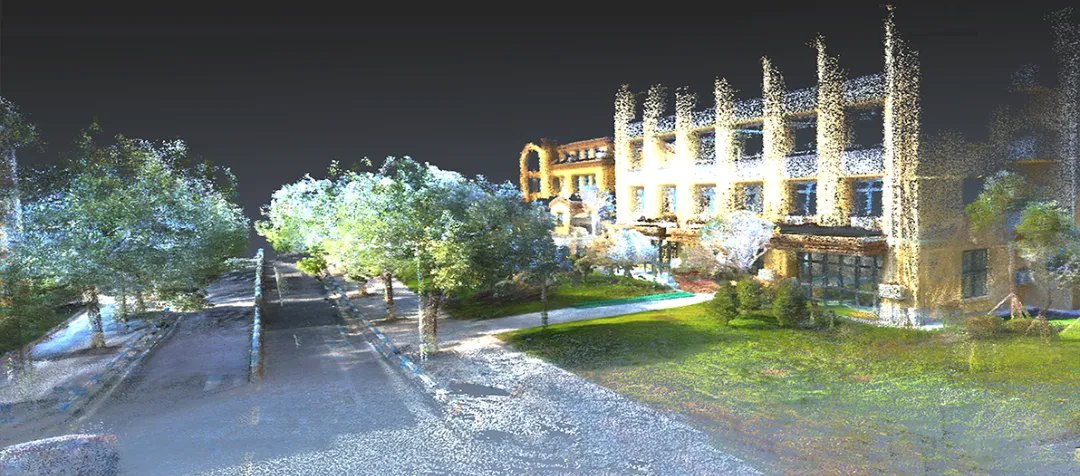
With a handheld scanner, the same job came out like this: instead of 3 people for 7 days collecting data and another person spending 7 days modelling — 1 person for 1 day collecting and 1 person for 1 day modelling. Resulting cloud accuracy: centimetre level.
An offshore transmission platform: measuring what the drawings no longer describe
An offshore transmission tower platform, built in 1979, scheduled for demolition and rebuild. The original documentation was hand-drawn, and the structure has spent four decades in seawater — the archive simply no longer describes what stands there.
Setting up a total station and prisms on an offshore platform is expensive and logistically awkward: access, a stable setup, weather, a narrow working window.
The handheld scanner captured the coordinates of the key points and let the team compute the true centres of each fixed pile — the precondition for installing the tower crane. Against the total-station approach: roughly 80% lower cost and twice the throughput.

Heritage documentation: colour point clouds of ornament
The scanner fuses the point cloud with a visible-light camera feed in real time, so the output is a true-colour cloud rather than bare geometry.
In a heritage wall reconstruction project the model resolved the carved detail finely enough that individual dragon scales stayed legible. Models like these do not stop at the conservation archive — they feed comparative condition analysis, and increasingly game and film production, where they cut the cycle against modelling from scratch.

What this means on the Polish market
The projects above come from Asia, but the problems they solve are exactly the ones Polish and European survey and contracting firms face. The applications our clients ask about most:
- as-built surveys and BIM models — where the model has to describe what was actually built
- industrial halls and warehouses — sites where shutting down for a survey costs more than the survey
- listed and protected buildings — where nothing may be drilled or glued on for reference targets
- basements, tunnels and culverts — GNSS-denied spaces where SLAM is in practice the only fast method
- volume measurement — stockpiles, silos, bulk material yards
Where the method stops working
Worth stating plainly, because marketing material usually doesn't: handheld SLAM does not replace the rest of the survey kit.
- It is centimetre accuracy, not millimetre. Control networks, deformation monitoring and acceptance work with sub-centimetre tolerances still need a total station or a terrestrial scanner.
- Long uniform corridors and empty halls are hard on SLAM. When the algorithm has nothing distinctive to match between frames, drift grows. The remedy is route planning with loop closure, plus control points.
- Georeferencing needs RTK or a tie to control. A SLAM cloud is internally consistent but floats in the global frame without a tie — which is why survey-grade scanners carry an RTK module.
- Glass, mirrored surfaces and water produce artefacts. That is a limit of laser ranging in general, not of the Mid-360.
A well-chosen tool is usually the one whose limits are built into the survey plan — not the one that pretends they aren't there.
Which scanners use it
The Mid-360 is a component, so it turns up in devices from many manufacturers. On the market you'll find it in XGRIDS Lixel handheld scanners, in the 3DMakerpro Eagle (a Mid-360 plus four fisheye cameras), and in the Hi-Target SLAM RTK V700S, which pairs SLAM with RTK positioning for crews working under weak or obstructed satellite signal.
If you are building your own device or integrating the sensor into an existing design — check the Mid-360 specification or get in touch; we'll advise which sensor in the Livox range fits your working envelope and accuracy requirement.