
Mid-360 LiDAR Enables Autonomous Navigation and High-Speed Drone Flight
With the advanced perception capabilities of the Mid-360 LiDAR, SUPER can efficiently detect and avoid thin obstacles such as wires, and is also able to autonomously navigate in dark environments.
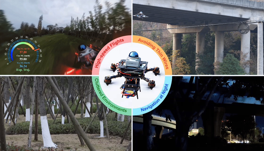
The MaRS Laboratory team at the University of Hong Kong recently introduced a drone system called SUPER (Safety-Assured High-Speed Aerial Robot) in the journal Science Robotics. Powered by Mid-360 LiDAR perception, the system is capable of autonomous flight at speeds exceeding 20 m/s in unknown environments.
High-speed flights
SUPER sustains autonomous flight above 20 m/s while continuously replanning its trajectory from live Mid-360 point cloud data.
Avoiding thin wires
The LiDAR's dense point cloud lets the drone detect and route around hazards as thin as power lines and guy wires.
Cluttered environments & night navigation
Dense tree cover and other unstructured obstacles are mapped and avoided in real time without prior knowledge of the site — and because Mid-360 relies on active laser ranging rather than ambient light, the same perception keeps working unchanged after dark.
Paper: Science Robotics, DOI 10.1126/scirobotics.ado6187 — open-source code: github.com/hku-mars/SUPER

