Compact 360° coverage replaces a set of several 2D sensors with a single module — it earns its place wherever weight, size and full scene coverage matter.
Mounted on multirotor platforms such as DJI Matrice 400, Mid-360 gives the aircraft real-time 3D awareness for terrain-following, making inspection flights safer.
Mid-360S & Mid-360 →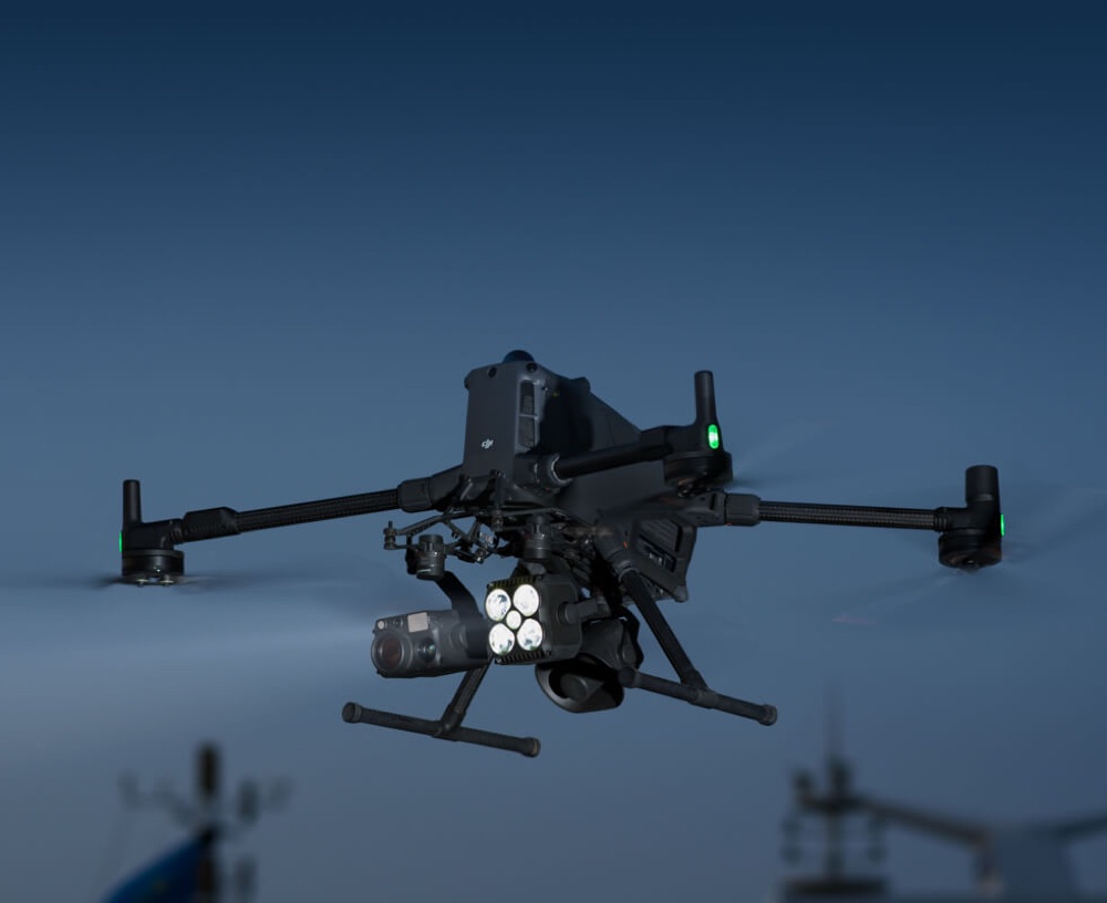
Real-time LiDAR point cloud visualization gives clearer, more intuitive obstacle detection than FPV alone. That matters most with small obstacles or night operations, giving agricultural drone operators better situational awareness and safety.
Mid-360S & Mid-360 →
Handheld systems — such as the Topcon CR-S2 — are one of the fastest-growing uses for sensors like the Livox Mid-360, pairing real-time SLAM positioning with dense, colorized point-cloud capture. Devices in this class share characteristic specs: up to 200,000 points per second and range up to 70 m at 80–90% reflectivity, with accuracy around 2 cm and single-operator use. Full horizontal coverage means the operator doesn't have to aim the head — they simply walk normally, and the point cloud builds up around them, vertically too: floor, walls and ceiling captured in one pass.
Typical applications include as-built documentation and scan-to-BIM, construction progress monitoring, underground space inventory, stockpile volume measurement, and rapid incident documentation. It's worth noting that mobile scanning carries trajectory drift — where single-point survey-grade accuracy is required, a static scanner or total station remains the right tool.
Mid-360S & Mid-360 →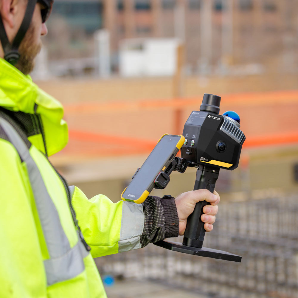
Mounted on AGV forklifts, Mid-360S delivers full 360° coverage around the vehicle, eliminating blind spots during loading and unloading in narrow warehouse aisles.
An IP67 housing at 265 g allows mounting on the cabin roof or a mast without modifying the load-bearing structure, while a built-in IMU and the Livox ROS Driver 2 shorten the path from prototype to production deployment.
The sensor handles perception and navigation — in applications subject to machine-safety requirements, it works alongside a certified safety scanner, not as a replacement for one.
Mid-360S & Mid-360 →In autonomous mobile robots (AMRs) and in legged robots such as Unitree, the Mid-360 LiDAR head delivers dense 3D data for mapping and navigation, replacing a set of several 2D sensors with a single compact module mounted on top of the platform.
Full horizontal coverage eliminates blind spots around the robot, so the same sensor handles localization, obstacle detection and docking — without adding directional sensors and without cross-calibrating several devices at different mounting heights. The tall vertical field of view matters especially on quadruped platforms: with every step the robot’s body rocks in pitch and roll, and a planar LiDAR loses its reference to the surroundings. The Mid-360 keeps both the floor and overhead structures continuously in view, which makes it possible to guide the robot over stairs, gratings and uneven technical terrain.
Mid-360S & Mid-360 →
In inspection robots, Livox Mid-360 removes the usual split between a “sensor for driving” and a “sensor for measuring”. The same head guides the platform around the site and, at the same time, records the point cloud that becomes documentation of the installation’s condition. For an integrator that means less hardware on board, a single data stream to synchronize and a lower unit cost per robot.
A 360° × 59° field of view covers everything around the platform with no blind spots — no array of directional sensors, no rotating head. A 0.1 m minimum detection range lets it work in tight passages and while docking. With a built-in IMU, an IP67 rating, 265 g and 65 × 65 × 60 mm, it fits even on a small platform.
Mid-360S & Mid-360 →

Kilometer range and a microscopic beam spot mean a single Avia 2 replaces many short-range sensors across large sites.
A single Avia 2 covers a stretch of power line up to a kilometer long, significantly reducing deployment costs. Its microscopic beam spot precisely detects thin objects: wires, branches or crane arms. Combined with non-repetitive scanning, it delivers rich point cloud detail, cutting down false alarms.
Avia 2 →Enables remote monitoring of track condition over long distances and detection of small obstacles — rocks, branches or slope slides — even in difficult weather. The wide 80°×80° field of view in Normal mode covers embankments on both sides of tunnel entrances as well as the overhead catenary system.
Avia 2 →In dusty, poorly lit environments such as storage yards or silos, the sensor effectively penetrates dust, delivering stable data with a high signal-to-noise ratio. A single device covers extensive material piles, simplifying inventory automation at a lower deployment cost.
Avia 2 →Thanks to its long range, a single Avia 2 covers extensive bodies of water. Combining non-repetitive scanning with centimeter-level accuracy captures consistent point clouds throughout a vessel's passage. The rain and fog noise reduction algorithm keeps performance stable in variable weather, supporting safe, round-the-clock navigation.
Avia 2 →